My Boundary Dispute Surveyor: Expert Resolution for Your Property Boundaries
Are you facing a boundary dispute with your neighbour? Our RICS chartered land surveyors provide professional boundary surveys to resolve disputes quickly and fairly. We're the experts in boundary dispute resolution across England and Wales.
Get Expert Help Today
Fill out this form and our boundary dispute surveyor will contact you within 24 hours
What We Do
Professional Boundary Survey Services
As specialist boundary surveyors, we help resolve boundary disputes between neighbours through accurate surveys and expert reports. Whether it's a fence, hedge, or invisible line dividing one person's land from another, we determine the exact boundaries of your property.
Boundary Dispute Surveys
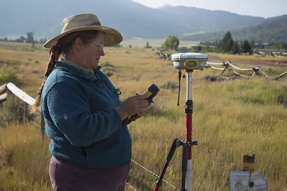
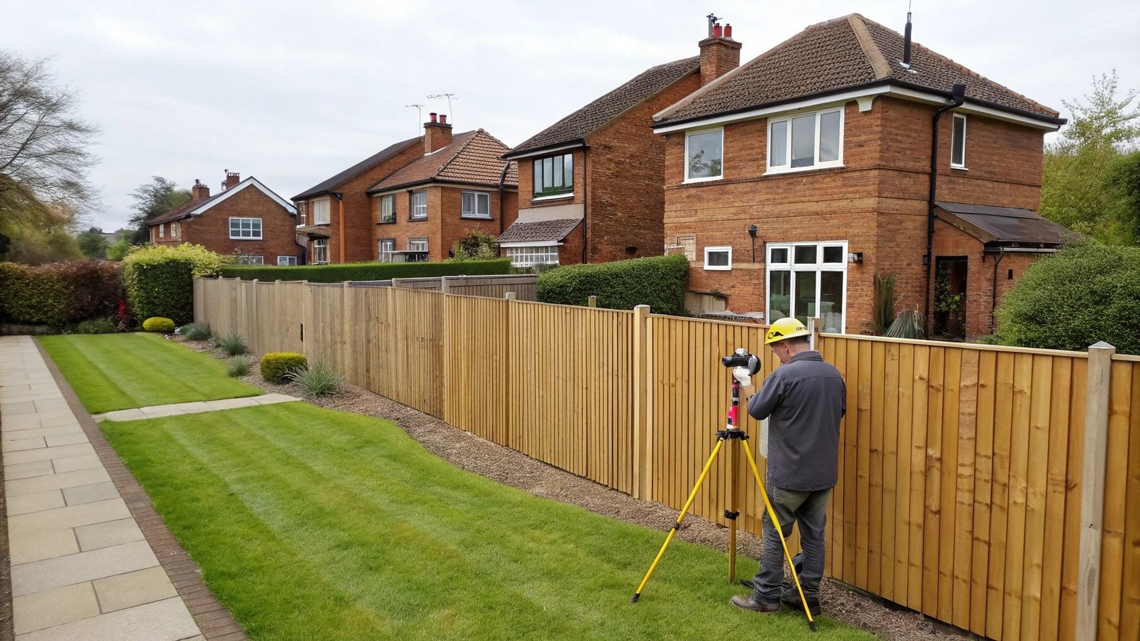
When a boundary dispute occurs between you and your neighbour, our chartered land surveyors conduct a detailed site visit to measure and map the disputed boundary. We use ordnance survey mapping and land registry title plans to determine the correct boundary position.
Learn More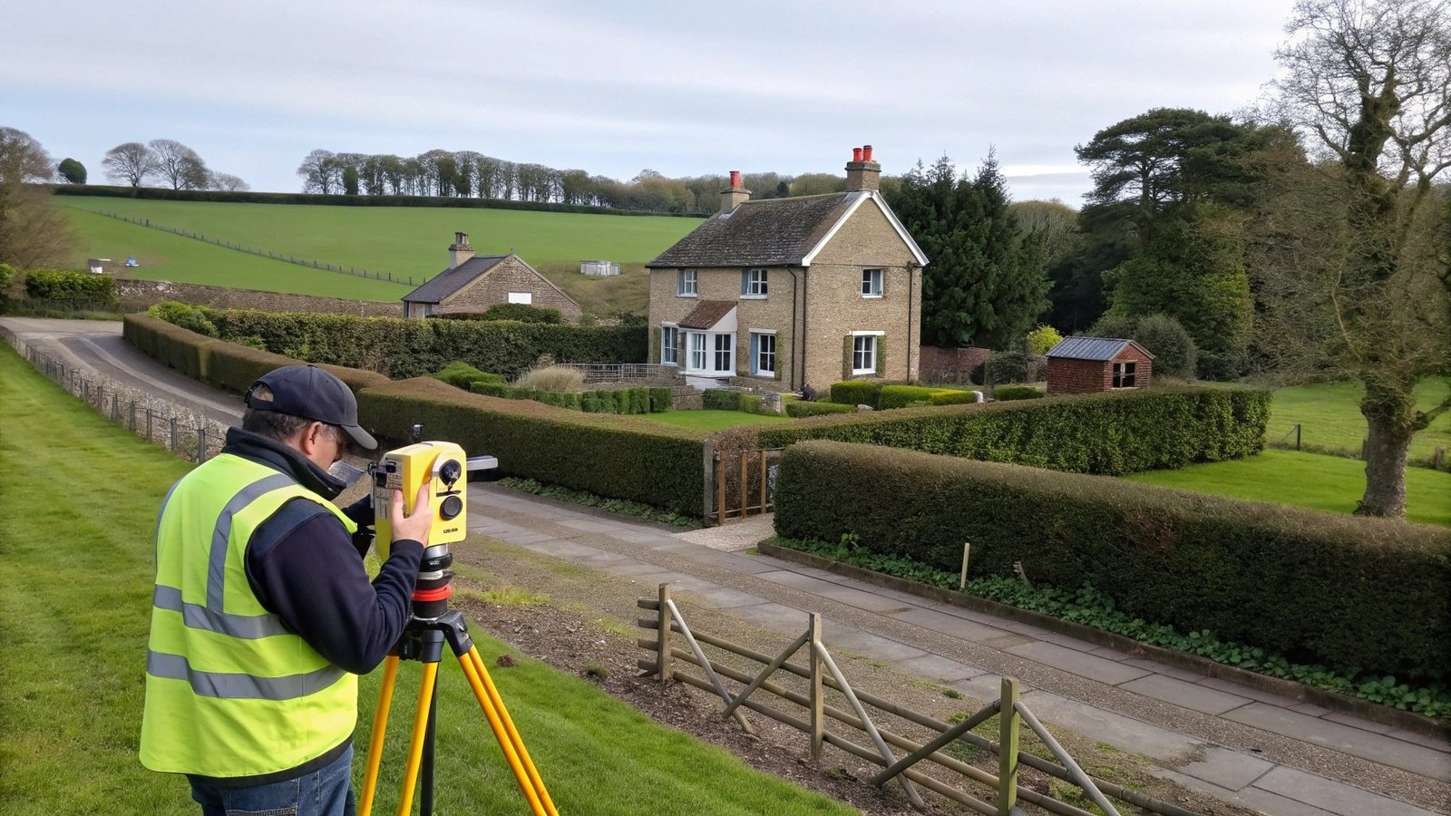
Topographic & Measured Surveys
Our topographic surveys show the physical boundaries and features on the ground. This type of report is useful for property purchase, conveyancing process, and understanding where the boundary lies in relation to land and buildings registered with HM Land Registry.
Learn More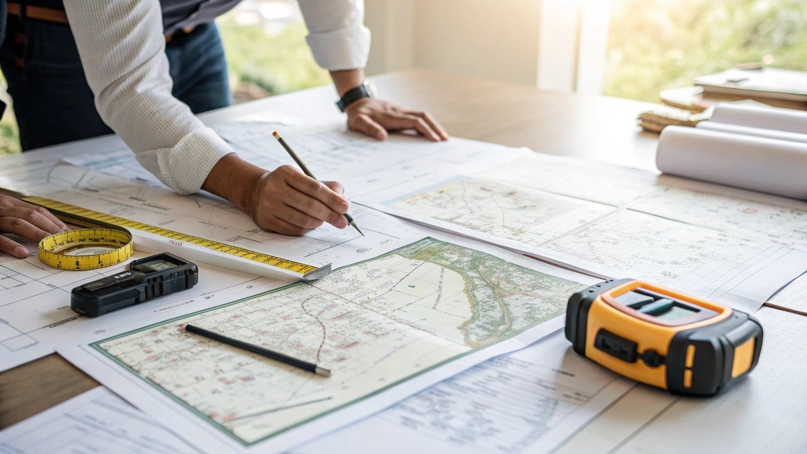
Expert Witness & Legal Advice
We act as expert witnesses in boundary disputes, providing impartial boundary reports that solicitors and courts rely on. Our RICS registered surveyors help you understand the position of boundaries and can instruct formal boundary agreements, saving thousands of pounds in costly legal action.
Learn MoreWhy Choose Us
Your Trusted Boundary Dispute Surveyor
My Boundary Dispute Surveyor brings together the expertise of RICS chartered surveyors with deep knowledge of land registry procedures, legal boundaries, and dispute resolution. We help neighbours resolve boundary issues without costly legal action in the first instance.
Fully Accredited Experts
All our land surveyors are chartered with RICS, CIOB, and RPSA. We're RICS registered professionals who follow a strict code of conduct, ensuring impartial and accurate boundary surveys every time.
Comprehensive Boundary Reports
Our boundary reports use ordnance survey mapping, land registry title plans, and OS mapping to show the general and exact boundaries. Whether it's a determined boundary or general boundary, we produce clear reports that resolve disputes.
Fair & Impartial Service
As a single joint expert, we serve both parties fairly. Our surveyors may act as independent experts to help neighbours understand the boundary in question and reach an agreed boundary without dispute between two parties escalating.
Cost-Effective Solutions
Resolve boundary disputes efficiently and save thousands of pounds compared to costly legal proceedings. We help resolve the issue without lengthy court battles, providing advice and guidance throughout the conveyancing process.
Quick Response Times
We understand that boundary issues need urgent attention. Our team responds within 48 hours and can schedule site visits quickly to assess the disputed boundary and begin resolving disputes promptly.
Legal & HM Land Registry Expertise
We work closely with solicitors and the Land Registry to ensure your boundary position is legally documented. From conveyance documents to formal boundary agreements, we guide you through every matter of law.
Our Process
How We Resolve Boundary Disputes
From initial contact to final boundary agreement, we guide you through every step of resolving your property boundary dispute with professionalism and care.
Initial Consultation
Contact us to discuss your boundary dispute. We'll provide advice and guidance on whether a surveyor may help resolve your issue and explain the type of report you'll need.
Site Visit & Survey
Our chartered surveyor conducts a detailed site visit to examine the boundary feature, measure the disputed boundary, and gather information about boundaries from features on the ground.
Research & Analysis
We review land registry title documents, ordnance survey data, and historical conveyance records. Title plans do not show exact boundaries, so we analyze all evidence to determine where the boundary lies.
Expert Report Delivery
We produce a comprehensive boundary report showing the boundaries of your property. Our reports are useful to identify the correct boundary position and may be used by solicitors or as expert witness evidence.
Client Reviews
What Our Clients Say
Don't just take our word for it - see what property owners across England and Wales say about our boundary dispute surveyor services.
"My Boundary Dispute Surveyor was brilliant. We had a fence dispute with our neighbour that was getting nasty. Their chartered surveyor visited, measured everything, and produced a clear report. The boundary lies exactly where we thought, and the dispute was resolved without going to court. Saved us thousands of pounds!"
"Excellent service from start to finish. Our solicitor recommended we instruct a RICS surveyor for a boundary issue during our property purchase. The topographic survey and boundary report were delivered quickly and helped us understand the position of boundaries. Their advice and guidance was invaluable during the conveyancing process."
"As a solicitor, I've worked with many land surveyors over the years. My Boundary Dispute Surveyor stands out for their professionalism and accuracy. Their boundary reports use ordnance survey mapping excellently and their expert witness testimony is always thorough. They truly understand that title plans do not show exact boundaries and know how to solve disputes effectively."
"We had a hedge boundary dispute that had been ongoing for years. My Boundary Dispute Surveyor acted as a single joint expert for both us and our neighbour. Their impartial approach and detailed measured survey helped us reach an agreed boundary. The boundary in question is now clearly defined and registered with HM Land Registry. Highly recommend!"
"Fantastic service! The boundary dispute occurs more often than people think during property sales. Using their RICS find a surveyor approach, I found My Boundary Dispute Surveyor and couldn't be happier. They understand legal boundaries and the land registry process perfectly. The boundary report shows the general position clearly and was accepted by both solicitors immediately."
"Professional, efficient, and knowledgeable. Our boundary dispute with the neighbour was getting stressful. Their chartered land surveyor explained everything clearly - from why title plans don't show exact legal boundaries to how features on the ground help determine the boundary position. They resolved the issue without costly legal action. Worth every penny!"
Common Questions
Frequently Asked Questions About Boundary Disputes
Get answers to the most common questions about boundary surveys, disputed boundaries, and how our RICS chartered surveyors can help resolve your property boundary issues.
A boundary dispute occurs when there's disagreement between neighbours about where the boundary lies between their properties. This might involve a fence, hedge, or other boundary feature. A chartered land surveyor can help by conducting a boundary survey, examining land registry title plans, using ordnance survey mapping, and measuring features on the ground to determine the correct boundary position. Our boundary reports provide expert evidence that helps resolve disputes fairly.
No, title plans do not show exact boundaries. HM Land Registry title plans show the general boundary only, usually to a scale where a line drawn represents about one metre on the ground. This is why boundary disputes happen - the land registry title plan shows the general position but not the exact legal boundary. A boundary surveyor uses additional evidence including historical conveyance documents, OS mapping, and physical measurements to determine where the boundary lies precisely.
A general boundary is what the Land Registry records by default - it shows the approximate position of boundaries but not the exact legal line. A determined boundary is a precisely defined legal boundary that's been formally agreed, measured by a RICS surveyor, and registered with HM Land Registry. The determined boundary process involves detailed surveys, agreement between neighbours, and official registration. Our chartered surveyors can help you establish a determined boundary to prevent future disputes.
Boundary survey costs vary depending on the complexity of the dispute and property size, but typically range from £800 to £3,000. While this may seem significant, it can save you thousands of pounds compared to costly legal action through the courts. Resolving disputes through a boundary surveyor in the first instance is far more cost-effective than litigation, which can cost tens of thousands. Our boundary reports often resolve the issue without further legal proceedings needed.
A boundary dispute surveyor should be RICS registered (Royal Institution of Chartered Surveyors) and ideally hold additional accreditations from CIOB or RPSA. RICS chartered surveyors follow a strict code of conduct and have the expertise to act as expert witnesses in boundary matters. They understand land registry procedures, legal boundaries, and conveyancing requirements. Always check a surveyor is RICS registered before instructing them - you can use the RICS find a surveyor service to verify credentials.
Yes, and this is often the most efficient way to resolve boundary disputes. A single joint expert is an impartial surveyor appointed by both parties in a dispute. This approach saves money (costs are shared), provides one consistent expert opinion, and speeds up resolution. Our RICS chartered surveyors regularly act as single joint experts, providing fair and unbiased boundary reports that both neighbours and their solicitors can rely on. This matter of law approach helps avoid a dispute between two parties escalating unnecessarily.
During a site visit, our chartered surveyor will examine the boundary in question, measure the physical boundaries and features on the ground, photograph the disputed area, and note any relevant landmarks or boundary features like fences, hedges, walls, or ditches. We use professional surveying equipment to take accurate measurements and compare these with the land registry title plan and ordnance survey mapping. The surveyor may speak with both neighbours to understand each perspective on where the boundary position should be. This comprehensive site visit forms the foundation of our detailed boundary report.
The timeline for resolving disputes varies depending on complexity. Simple boundary surveys can be completed within 2-3 weeks from initial instruction to final report delivery. More complex cases involving extensive historical research, multiple properties, or difficult access may take 4-8 weeks. However, this is far faster than legal proceedings which can take many months or even years. We aim to respond to enquiries within 48 hours and schedule site visits quickly. Our efficient process helps neighbours reach an agreed boundary as soon as possible, minimizing stress and preventing costly legal battles.
Ready to Resolve Your Boundary Dispute?
Don't let a boundary dispute with your neighbour escalate. Contact My Boundary Dispute Surveyor today for expert advice and guidance from RICS accredited professionals. We're here to help you understand the boundaries of your property and resolve the issue without costly legal action.
Get Your Boundary Survey Quote
Complete this form and our chartered surveyor will contact you within 24 hours to discuss your boundary dispute